Crop Variety Classification through Hyperspectral Imagery
.png)
Remotely sensed imagery from satellites, aircraft, or ground-based sensors is pivotal in precision agriculture — a farming management practice that gathers, processes, and analyses different data to determine inter and intra-field crop variability. In particular, hyperspectral imagery is a valuable tool in this field. With precision agriculture, farmers can apply fertilisers, pesticides, tillage, and irrigation water more effectively and improve crop yields while minimising environmental contaminants.
Traditionally, spectral imaging sensors have been used to capture crop images in specific wavelengths beyond the visible spectrum. However, these commercially available sensors often lack the spectral resolution required to identify and quantify small changes in plant physiology resulting from diseases or other environmental stressors.
Hyperspectral imaging has shown the potential to shift how precision agriculture is managed. The high spectral resolution available on hyperspectral sensors can be utilised for crop variety classification, enabling farmers to customise management practices, monitor health and growth, and optimise input usage, costs, and nutrient content.
What is variety classification?
Variety classification identifies and categorises crop varieties based on unique characteristics such as genetic makeup, appearance, growth rate, yield potential, and resistance to pests/diseases. Crop varieties are diverse and abundant, with each possessing unique traits and characteristics.
Choosing the right crop variety is crucial in disease detection and management since resistant varieties can minimise the need for chemical treatments and reduce disease risk. Variety selection also mitigates the impacts of extreme weather events like drought. For example, drought-tolerant maize varieties can produce approximately 30% of their potential yields after suffering water stress for six weeks before and during flowering and grain-filling.
Each crop variety emits a different spectral signature — a unique pattern of reflectance or absorption across wavelengths due to their inherent biochemical and physiological characteristics. One of the main reasons why these vary is due to chlorophyll content, which absorbs light in the blue and red parts of the spectrum and reflects green, giving plants their colour.

Drought-tolerant crops exhibit different physiological and biochemical characteristics due to their ability to withstand water stress and decreased nutrient content and as a result, their spectral signatures vary as well.
Previous remote sensing techniques used in agriculture
So far, hyperspectral imagery in precision agriculture has revolutionised the mapping and monitoring of vegetation growth and health. While multispectral imaging has been used in agriculture for this purpose, capturing data across only a few narrow wavelength bands, it falls short in comparison.
Multispectral imagery can derive basic vegetation indices like the Normalised Difference Vegetation Index (NDVI), which assesses plant health based on greenness and density. However, the limited spectral resolution of multispectral sensors hampers the ability to accurately identify crops, as they lack sensitivity to subtle variations in reflectance spectra. Consequently, multispectral imaging is not ideal for crop variety identification or other detailed classification tasks.

How can hyperspectral imaging support variety classification?
Hyperspectral imagery in precision agriculture revolutionises crop monitoring and management with its powerful capabilities. Equipped with hyperspectral sensors, Earth observation satellites capture data across hundreds of narrow wavelength bands, enabling the detection of subtle differences in the spectral signatures of different crop varieties.
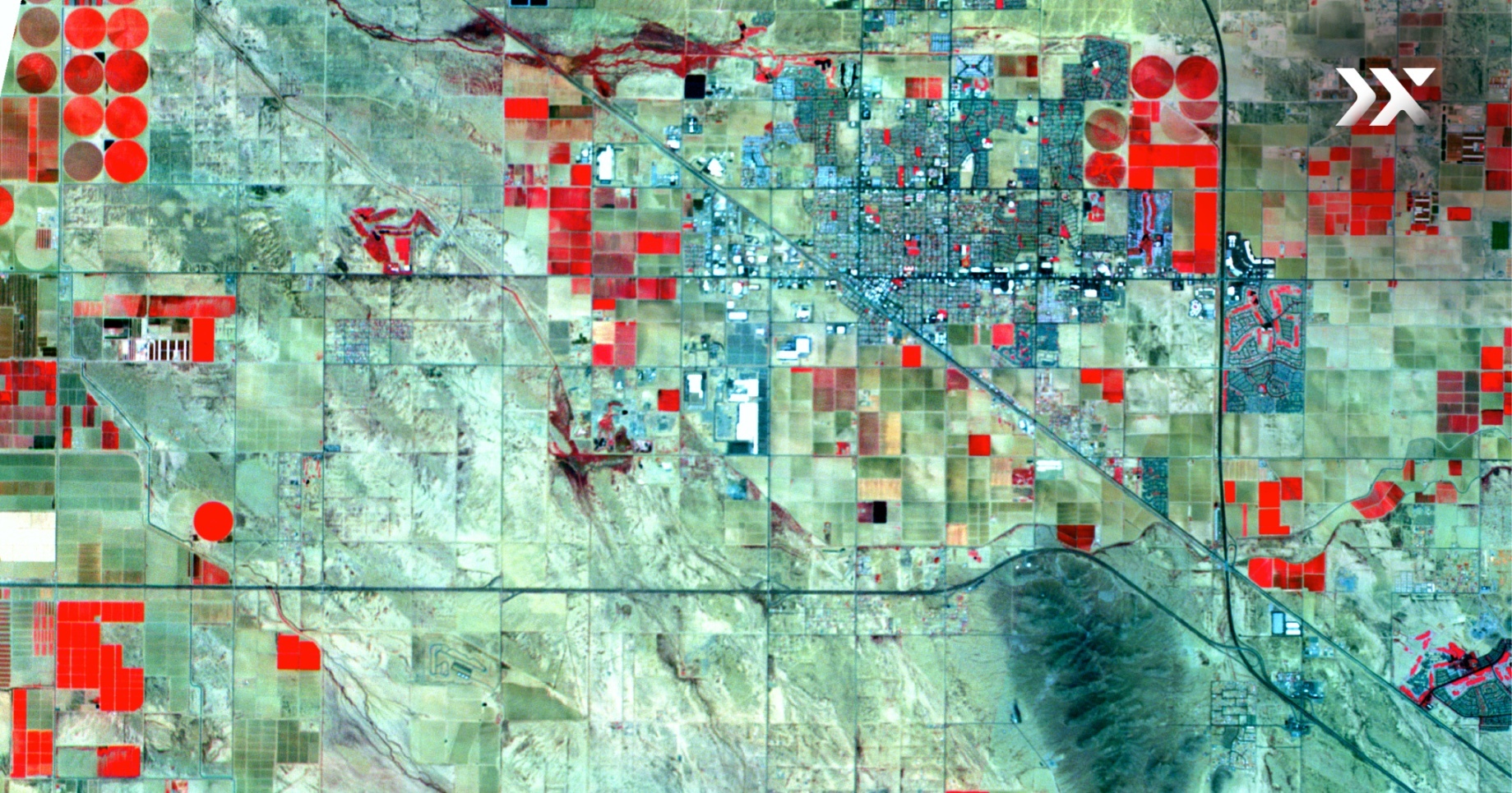
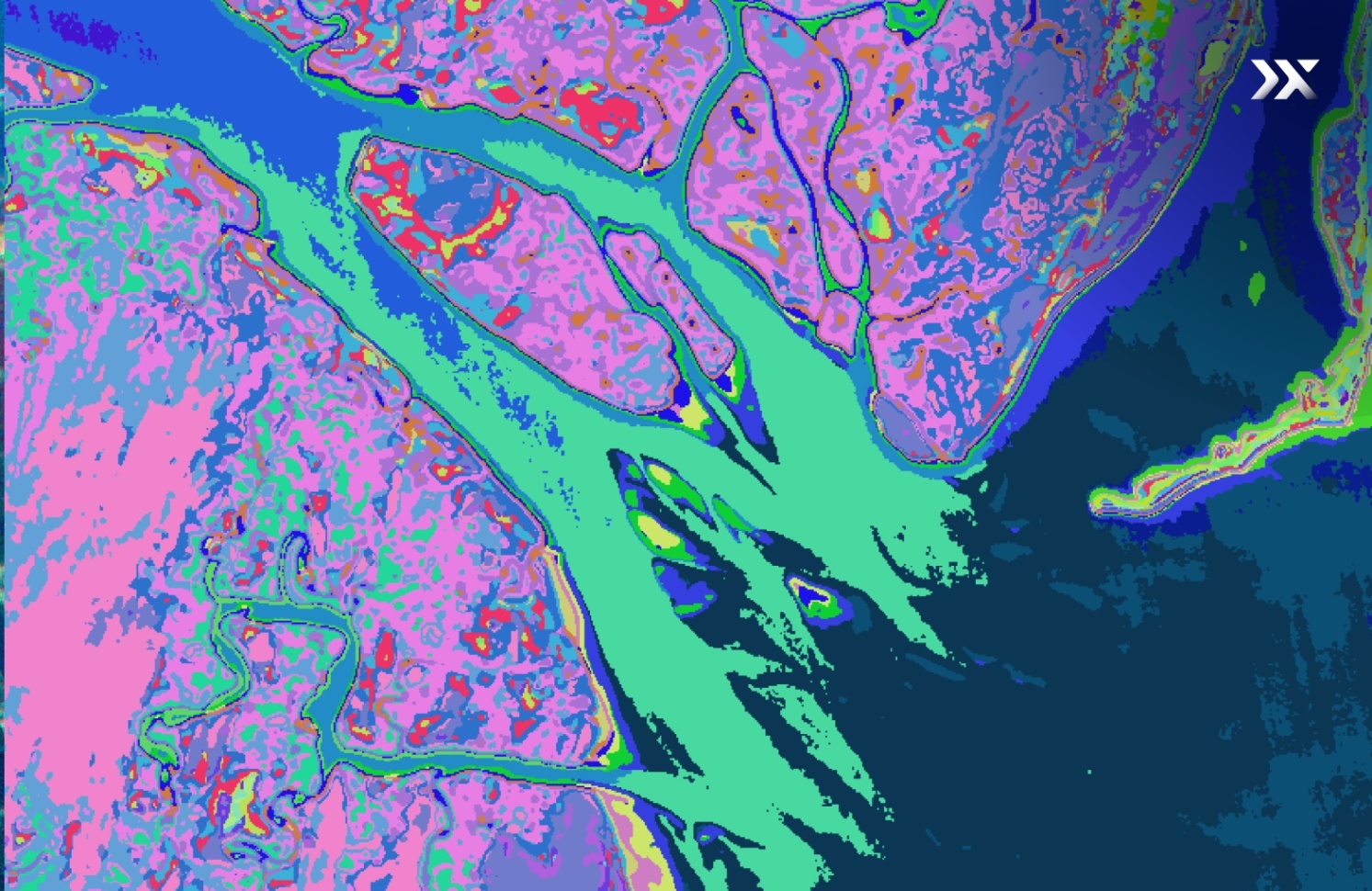
Usually, time series are needed for crop classification, but with hyperspectral data, we can create a map from a single image for very similar-looking species that are usually difficult to discriminate. The ability to classify different varieties of crops based on these unique spectral signatures, influenced by chemical composition, pigmentation, water content, and environmental conditions with hyperspectral imaging satellites has wide-ranging applications in precision agriculture.
.png)
Hyperspectral imaging provides agricultural organisations with the toolkit to map, measure, analyse, and monitor their crops more accurately. This technology allows agronomists to differentiate between different crops and their varieties, develop accurate distribution maps, and identify areas requiring more or less inputs. It additionally allows for the quantification and analysis of crop performance by measuring parameters like chlorophyll content, water content, and disease symptoms, flagging thriving or struggling areas, optimising planting strategies, and improving profitability.
Consistent monitoring of crop health is possible with hyperspectral imaging, allowing farmers to make timely and scientifically supported decisions about crop feasibility, inputs, and harvesting. Further, crop management practices, such as inventory control, insurance claims, and consultancy services can all benefit from accessing hyperspectral imagery over their croplands.
As the global population continues to grow, ensuring sustainable and efficient food production is critical. Advanced remote sensing technology, including Pixxel's hyperspectral imaging satellite sensors, offers a promising solution for precision farming practices, providing farmers with precise and reliable crop classification capabilities that can enhance their decision-making and contribute to more sustainable and productive farming practices.
Moreover, future advancements in remote sensing technology, including the development of new algorithms to detect minute variations in plant physiology, can further improve the monitoring and management of agricultural resources, leading to more efficient and effective farming practices.
Get in touch with Pixxel’s sales team to learn more about the hyperspectral advantage in agriculture.
(Content revised on 7th March 2024)


