Revealing Nature's Spectrum: Applications of Hyperspectral Imaging in Protecting Biodiversity

A shocking 2019 report assessing the state of global biodiversity highlighted the alarming reality that around a million species are threatened with extinction. These findings, along with other studies, have pressured policymakers into action, implementing national plans aimed at safeguarding and revitalising ecosystems to support biodiversity.
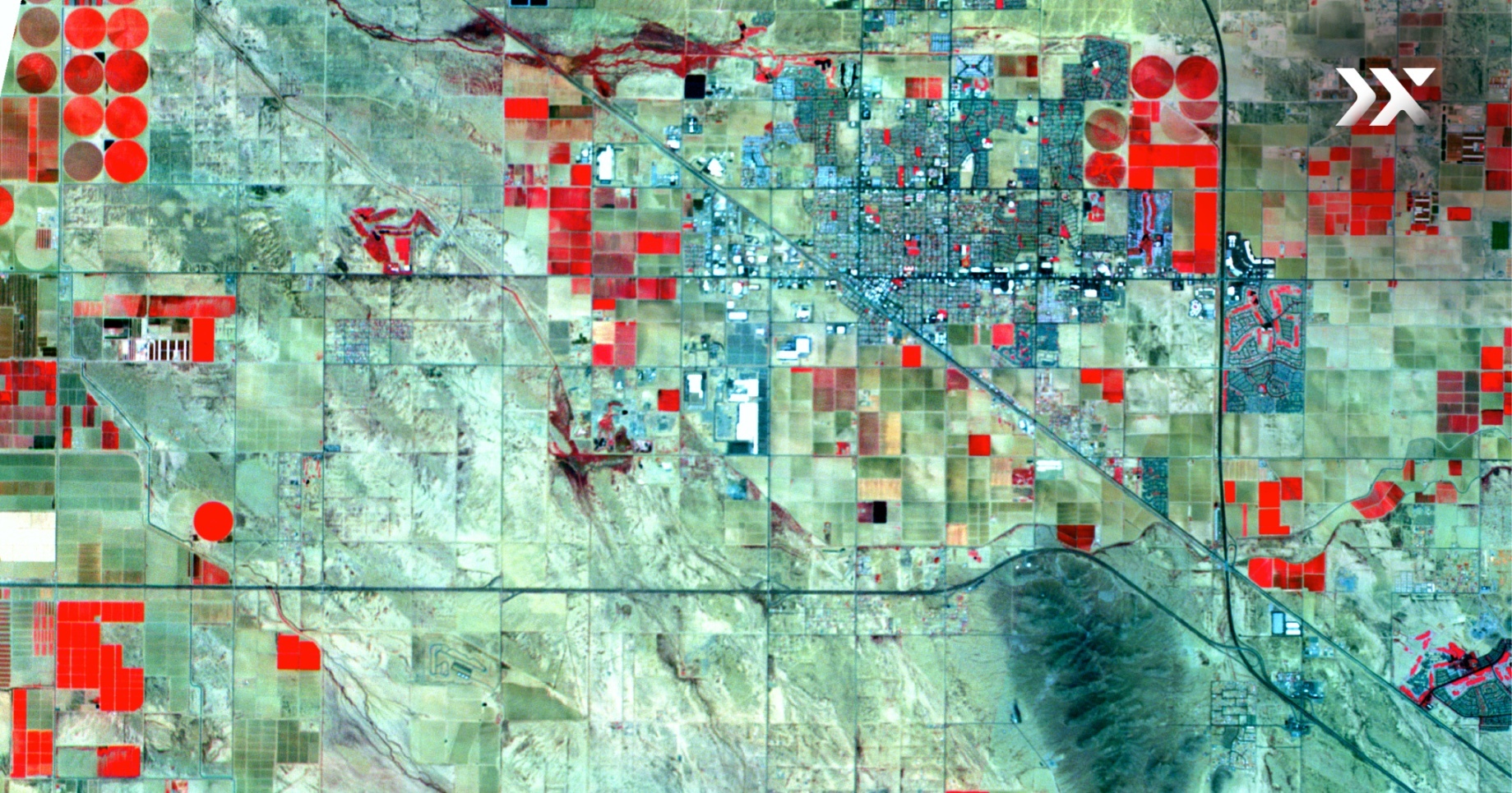
Such plans emphasise the integration of biodiversity monitoring across various sectors reliant on the environment. In this regard, space-based remote sensing technologies emerge as a valuable resource, specifically hyperspectral imaging that enables efficient monitoring of extensive regions and ensures transparency in environmental assessment and management.
Understanding Biodiversity
Plant biodiversity plays a crucial role in shaping the overall richness and complexity of an ecosystem, supporting the interconnectedness of different organisms and promoting ecosystem stability. To better understand and preserve biodiversity, mapping plant diversity is essential.
Plant diversity mapping involves systematically collecting and analysing data regarding the distribution, abundance, and composition of plant species in various ecosystems. This valuable data can inform us about ecosystem health and resilience, help to identify areas of high conservation value and support conservation efforts. However, traditional methods of plant biodiversity mapping are labour-intensive and time-consuming, resulting in data gaps and biases. Enter a game-changing solution: hyperspectral imaging.
Unleashing the Power of Hyperspectral Imaging
Space-based hyperspectral imaging offers exciting possibilities for biodiversity monitoring and land cover analysis. Multispectral imaging produces reliable habitat maps, identifying broad land cover categories with remarkable accuracy. However, hyperspectral imaging steals the spotlight when distinguishing at the species level.
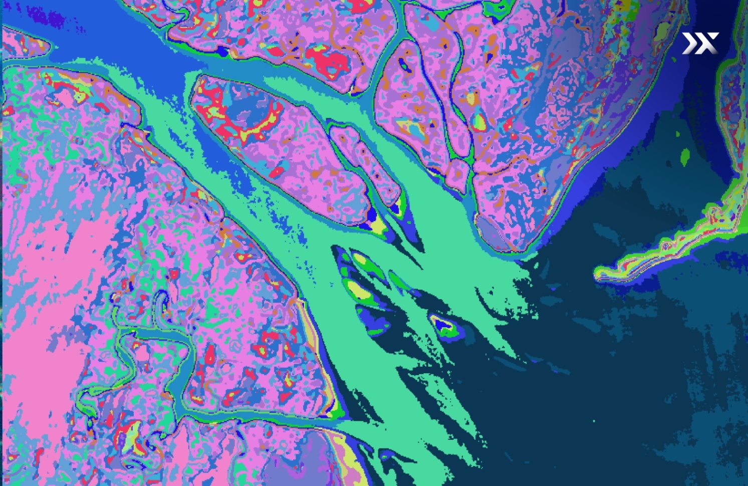
Hyperspectral imaging allows us to delve deeper into the details of specific land covers. Through the analysis of spectral features of reflected and absorbed light in a target scene, hyperspectral data can determine vegetation species and soil types.
Multiple studies have highlighted the superiority of hyperspectral imaging in extracting vegetation information and distinguishing plant species compared to multispectral imaging 1, 2. This is because hyperspectral imagery contains hundreds of spectral bands, while multispectral imagery contains dozens. The low spectral resolution is often not sufficient to accurately distinguish between vegetation species over the target area. Moreover, hyperspectral imagery provides valuable information on plant properties, including leaf pigment, water content, and chemical composition, offering vital indications on the health of the ecosystem 9.
Through the remarkable integration of space-based hyperspectral imaging into conservation efforts, we unlock a powerful tool for understanding and protecting the intricate web of life, right from comprehending ecosystem services to monitoring forest health.
Forest Health Monitoring
Forests play a crucial role in maintaining biodiversity. The high spectral resolution of hyperspectral sensors allows for the analysis of tree characteristics, foliar chemistry, and other structural parameters. This enables the tracking of changes in biodiversity over time and identifying diversity hotspots across heterogeneous tropical forest ecosystems. In particular, tropical forests standout as the most diverse and ecologically complex ecosystems on Earth.
Hyperspectral data analyses the spectral variability of forest canopies by identifying biochemical and biophysical parameters within the visible and infrared regions of the electromagnetic spectrum (except for a few found in the SWIR regions). Parameters including leaf area index, chlorophyll content, plant height, and biomass are vital for determining inter-species variations in leaf biochemical composition.
Preserving Wetlands
Wetlands, such as mangroves and peatlands, are amongst the most productive ecosystems, providing a range of ecosystem services, including nutrient recycling. In particular, hyperspectral imaging is used to accurately measure carbon content by assessing spectral characteristics of ground conditions.
These measurements can serve as a proxy for vegetative biomass and primary productivity, allowing for estimations of carbon sequestration modelling. These insights are crucial for preserving these vital ecosystems and the ecosystem services they provide.
The Crucial Role in Biodiversity Net Gain Reports
The demand for biodiversity net gain (BNG) reports, which evaluate habitat condition, fragmentation, and diversity, has grown significantly across public and private sectors. These reports play a pivotal role in an ongoing strategy to support land development practices, “making sure the habitat for wildlife is in a better state than it was before development”. The calculation of BNG involves comparing baseline conditions with post-development habitat data.
In addressing these crucial needs, hyperspectral imaging provides essential insights into the status of the habitats before and after development. Beyond accurately classifying diverse habitats, hyperspectral data unveils critical information on the health of individual species' leaves, reveals the presence of invasive species, and assists in the calculation of biomass and carbon sequestration.
With such comprehensive insights at their disposal, organisations can generate accurate BNG reports, make well-informed decisions, and take actions that foster biodiversity conservation.
A Call for Collaborative Action with Pixxel
Monitoring and safeguarding biodiversity is a collective responsibility that spans various sectors reliant on the environment. From agriculture to government agencies responsible for biodiversity stewardship, numerous industries benefit from the insights provided by hyperspectral imaging. By revealing nature's hidden spectrum, this cutting-edge technology offers unprecedented opportunities for informed decision-making and effective conservation strategies.
Pixxel catalyses change, paving the way towards a sustainable future through the power of space-based technologies. By harnessing the capabilities of hyperspectral imaging, we can harmonise human activities while keeping ecosystem preservation (and regeneration) in mind, actively contributing to a healthier planet.
Let Pixxel be your guide in embracing the potential of hyperspectral imaging. Together, we can drive positive change and full transparency in environmental reporting, creating a world where human progress and environmental preservation coexist.