
Aurora By Pixxel: Turning Satellite Data Into Real Insights
Aurora is Pixxel’s in-house Earth Observation Studio that makes satellite data intuitive to explore and ready to use. Built for seamless analysis, it bridges the gap between complex imagery and confident decision-making.
Endless Possibilities.
One Platform.
Aurora brings together open-source Earth Observation datasets, ready-to-use models and indices, and Pixxel’s upcoming hyperspectral imagery in one unified platform. Its no-code interface and customisable workflows remove the friction of traditional tools, making it easier to work with satellite data across different needs and teams.
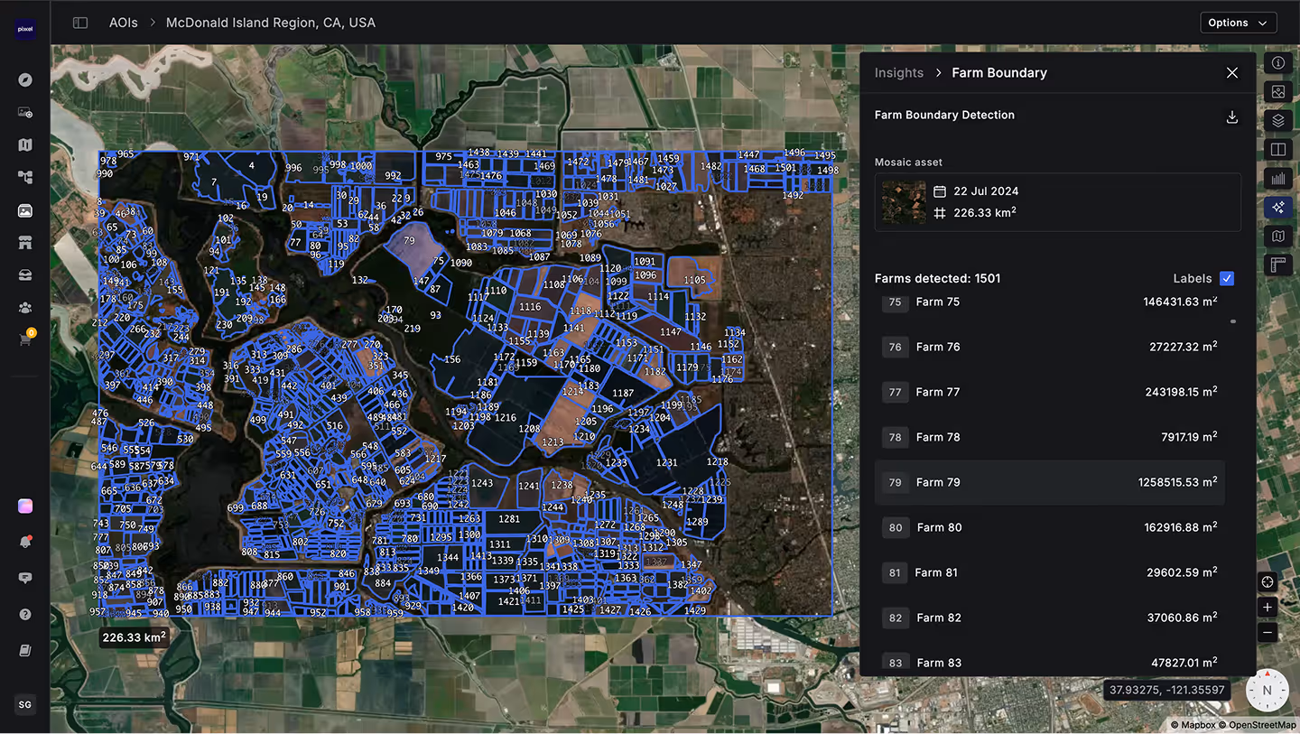
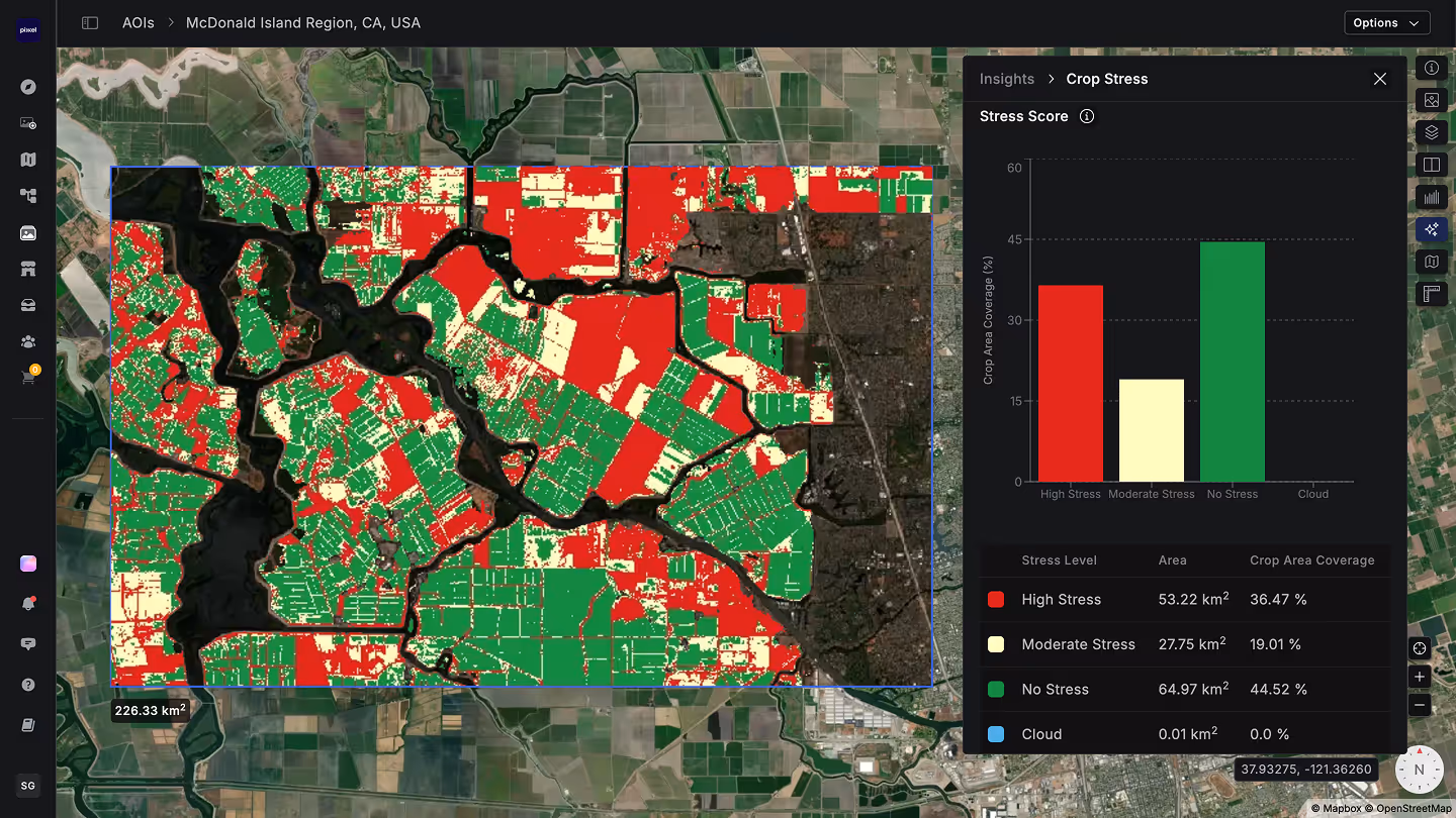
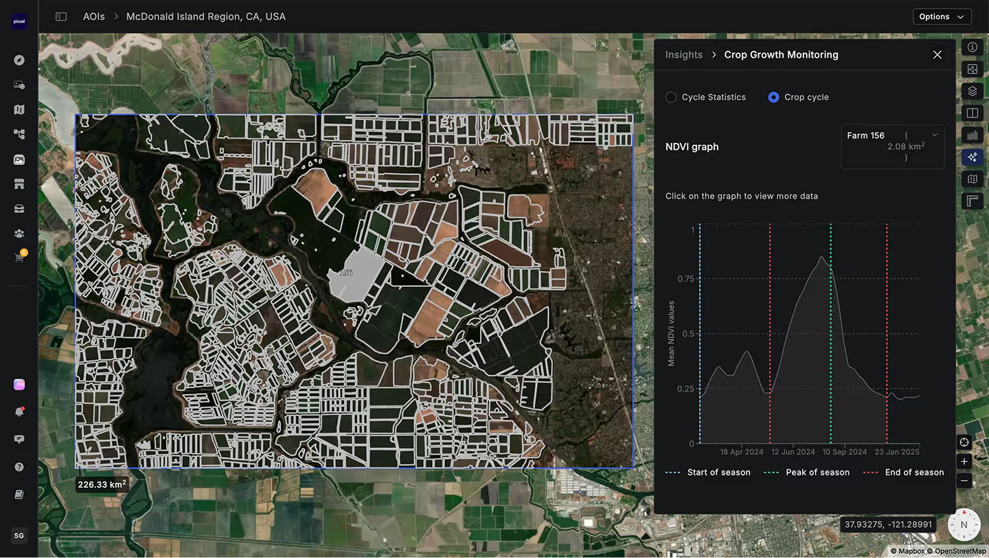
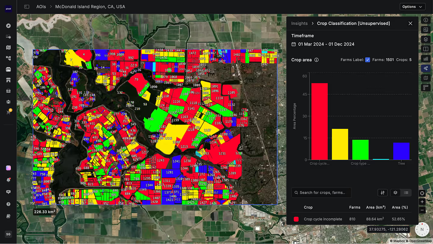
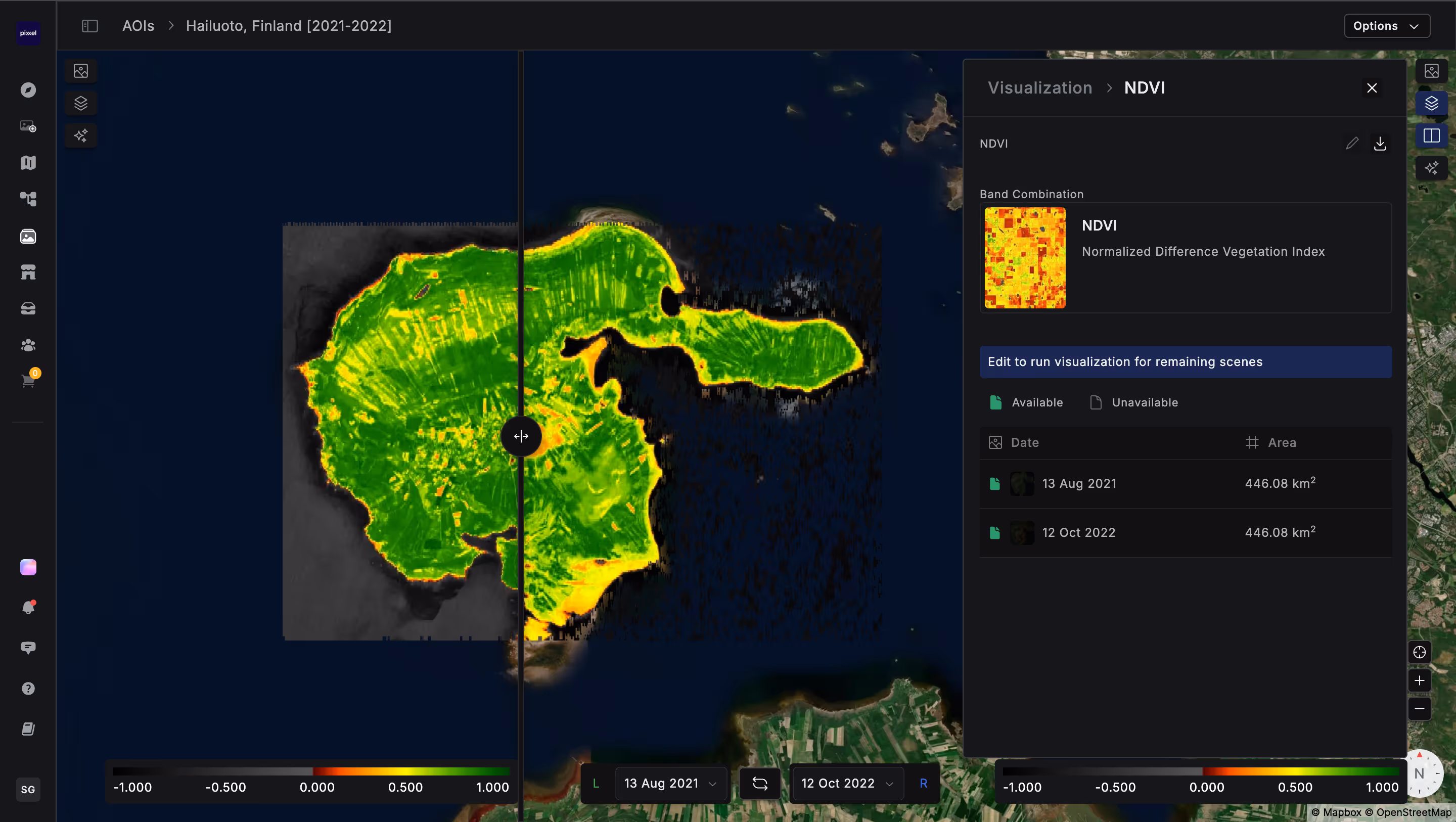
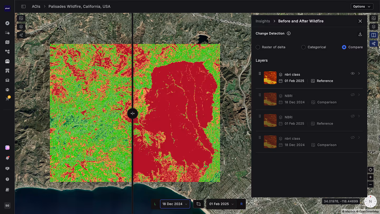
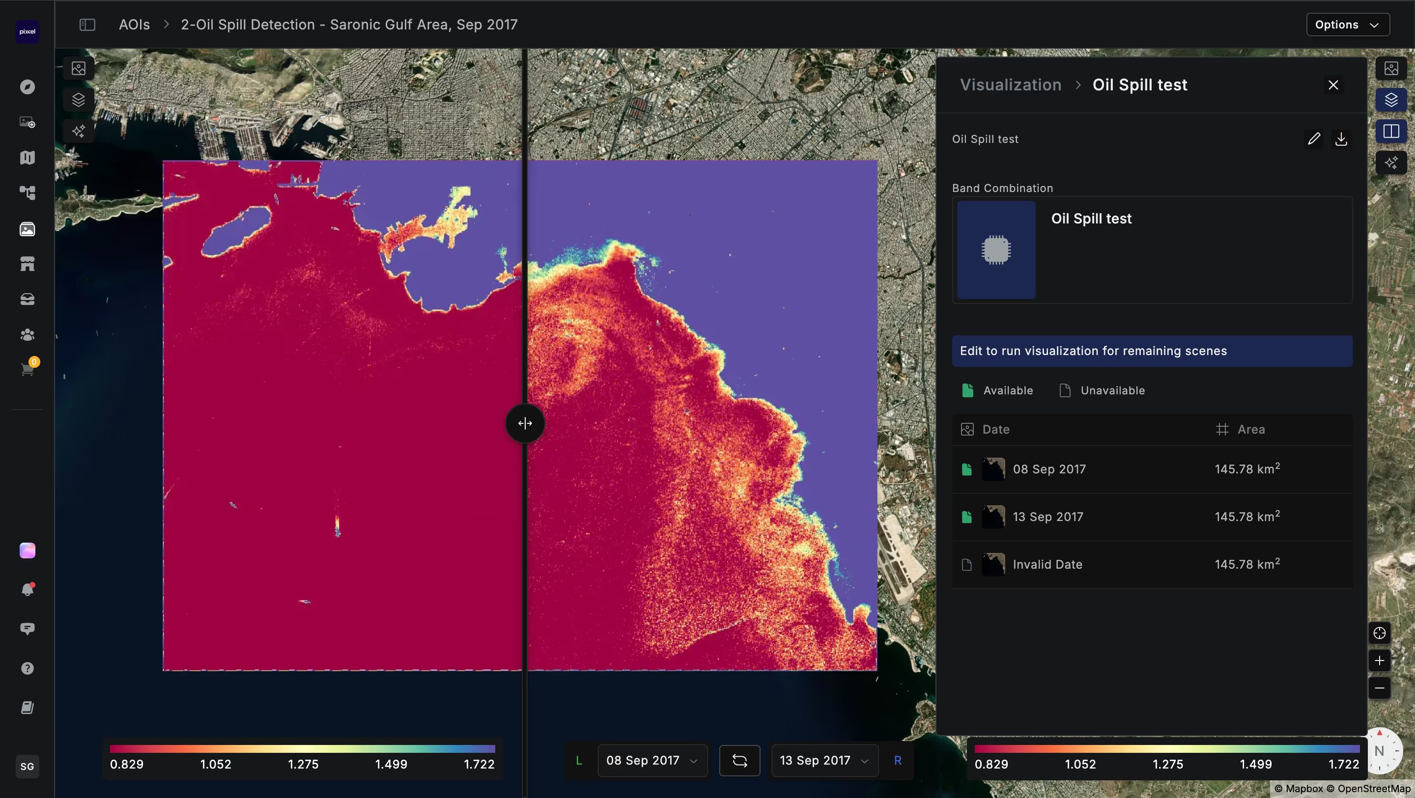
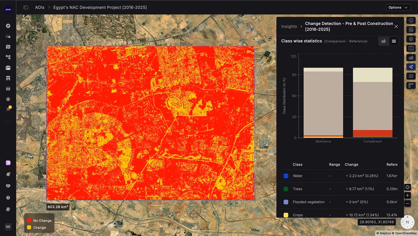
With Aurora, You Can

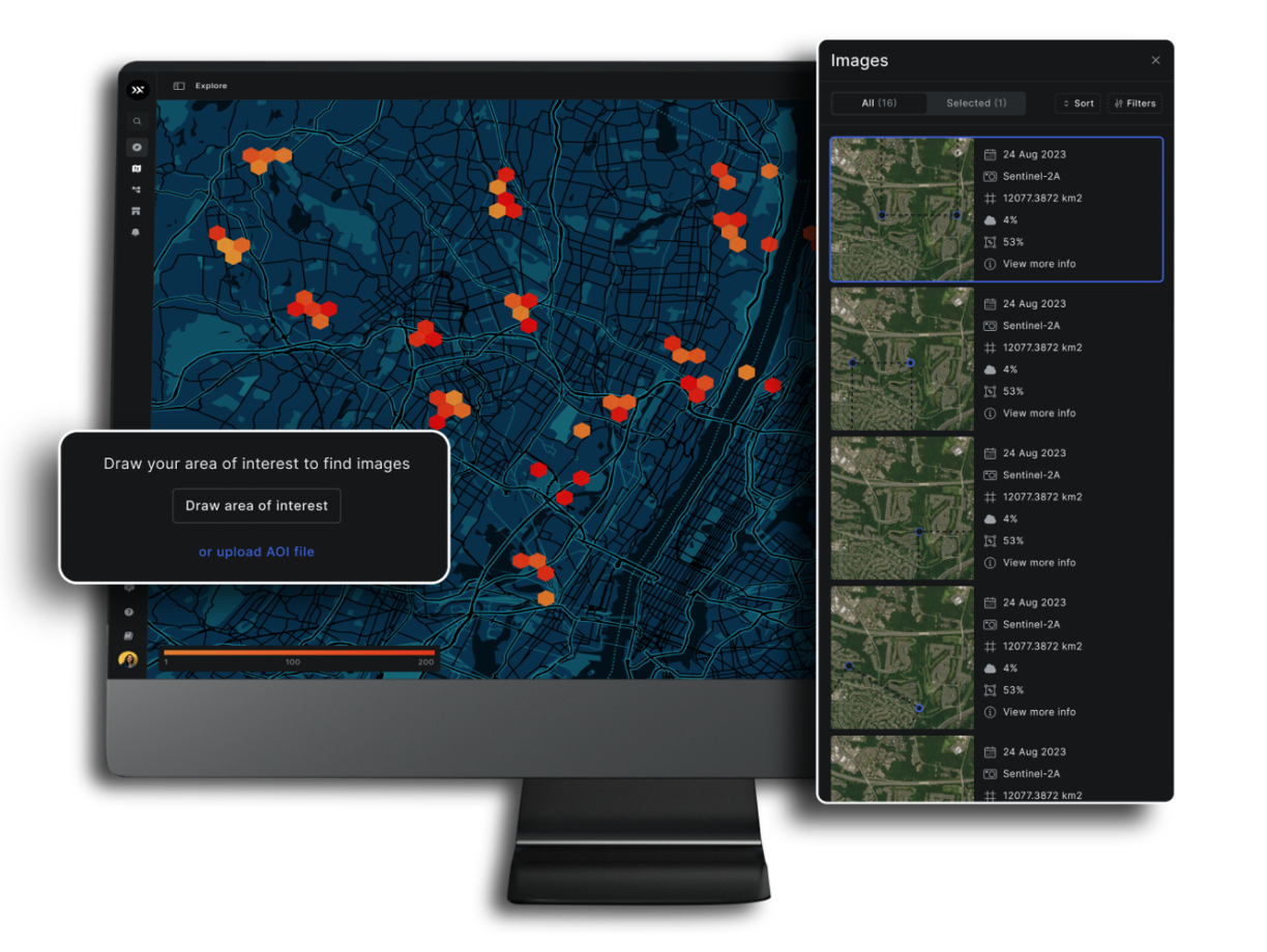
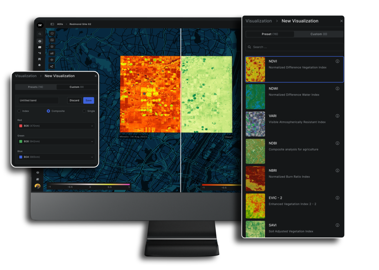
or select from archives

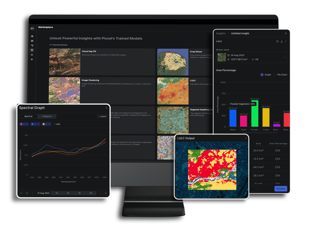
with quantified information

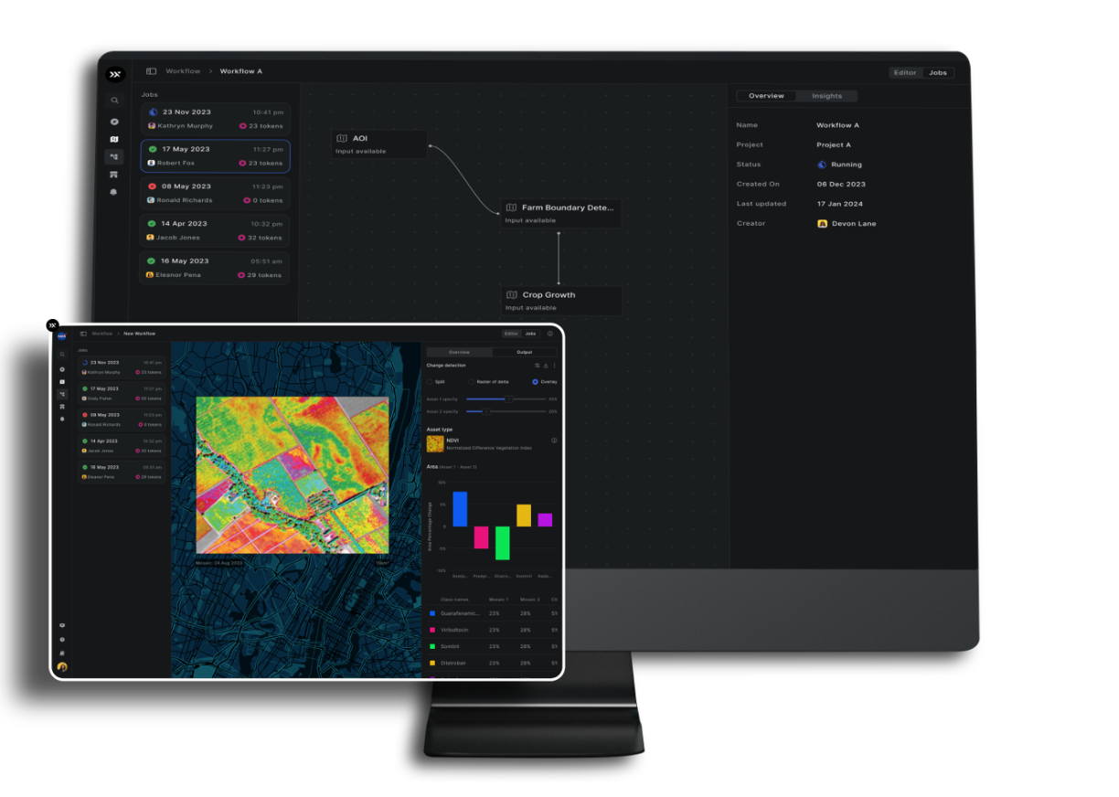
with workflows and APIs

experience powered by AI


What Sets Aurora Apart

Accessible
No installation needed, accessible via browser with API support.

Interoperable
Connect with open-source
and third-party datasets effortlessly.

Intelligent
Quick onboarding, intuitive UX, AI-powered tools, and fast processing.

Transparent
Clear per km² pricing, model accuracy insights, and detailed documentation.
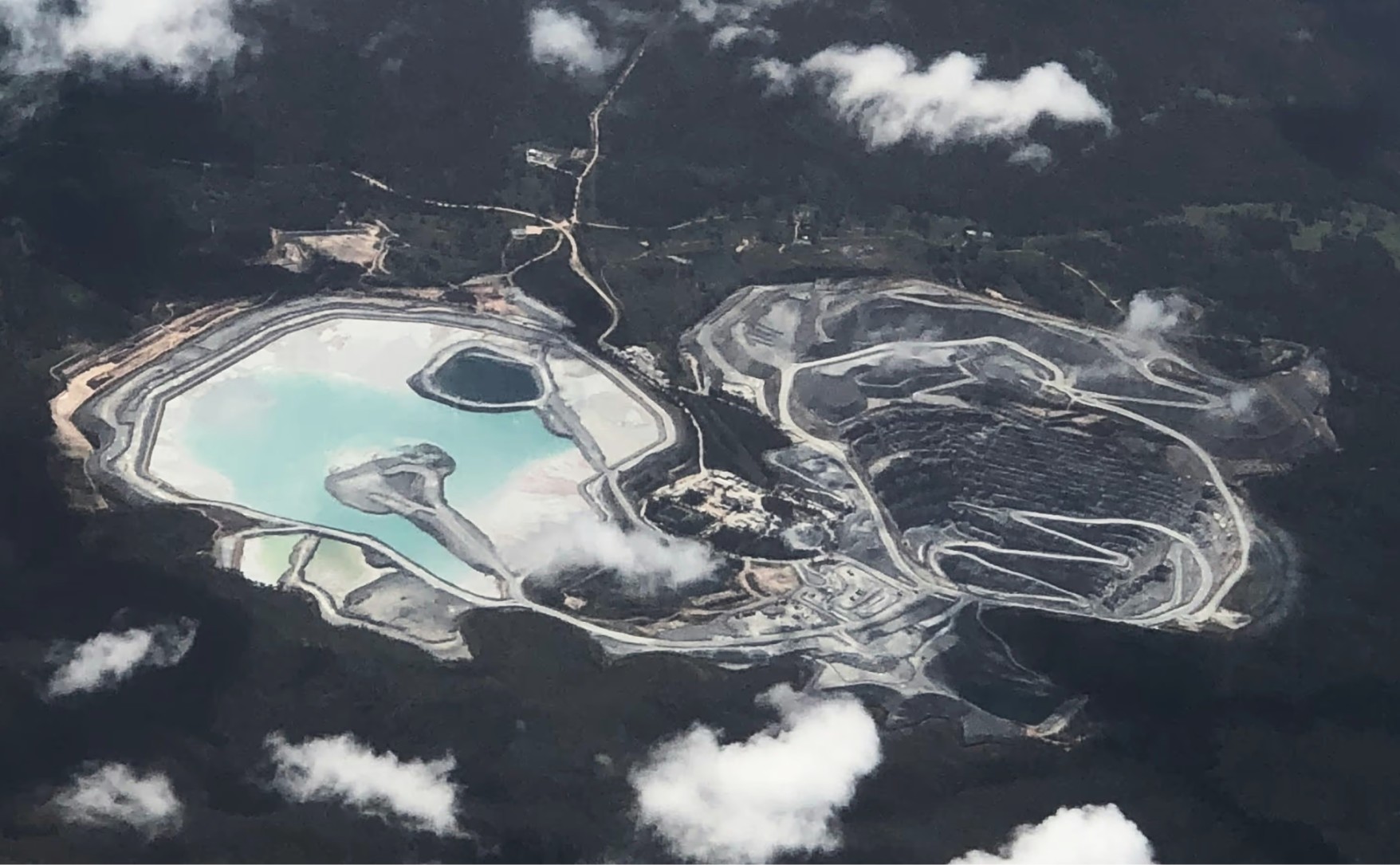
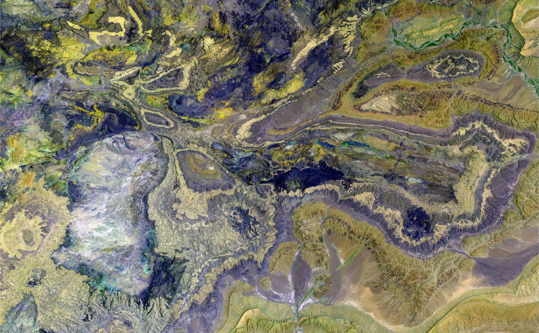
See What You Can
Do With Aurora


%201.avif)


Pricing
Scalable Plans
For Every Team


$150 billed monthly
$200 billed monthly

Knowledge Hub
Learn how Aurora by Pixxel turns satellite imagery into actionable insights for your mission.
.png)

.png)